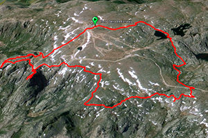
ROUTE OF 25 LAGOONS
For all types of routes, trails and other tours, it is advisable to use the tourist map of the Serra da Estrela Natural Park
Tower Lagoons Trail
Duration: 3h Distance: 8km
The starting point for this pedestrian circuit is a mythical place: the Tower – the highest point in mainland Portugal. Hence, the view reaches culminating points, extremely distant, from the Serra da Boa Viagem in Figueira da Foz, to the Serra de Gredos in Spain; do Marão in Trás-os-Montes to Serra de Portalegre in Alentejo. Almost half of the Portuguese territory and some Spanish can be seen from the Tower. From the rear of the facilities that used to shelter the old radars, next to the chapel, head west along the path towards Poio da Estrela (1931m). Marginando to the right, lower for the left, you will see the water line that passes in the spur that separates the Lagoons of Covão from Quilhas of Lagoa Serrano. Cross the wall of Lagoa do Covão das Quilhas and follow the water line to Covão do Boeiro. Follow the Garganta de Loriga, a glacial valley made up of four depressions (covões), excavated by the ice and located on a step. After the wooden bridge, take the path on the left that goes down to Covão do Meio. Now go to the national road passing through the ruins of a chapel. Crossing it at Fonte dos Perus, where you will find a landmark, known as Cume (1858m), or Planalto da Expedição. From the summit go towards the east. Walk along the Salgadeiras Lagoons. Turn right towards the road and continue until the Tower where you will end this trail.
