ALFORFA GLACIER VALLEY
Located in the opposite projection of the Manteigas Glacier Valley, it originated from a glacier that reached 5.5 km in length and dissolved at an altitude of 800 m.
Its greater sun exposure in relation to the opposite valley justifies this difference in altitude at the end of the glacier (120 m). However, this is the valley where the terraces of proglacial accumulation, disorderly accumulations of rocks and large blocks located in front of the old glaciers can best be seen.
For this Glacier Valley, two possibilities are proposed, which we leave to the visitor: cover it in full and take advantage of the full magnitude of the route or simply take the route by car, which is the most convenient and feasible for people with little availability of time.
Pedestrian path: Duration: 4: 50h Distance: 13 km.
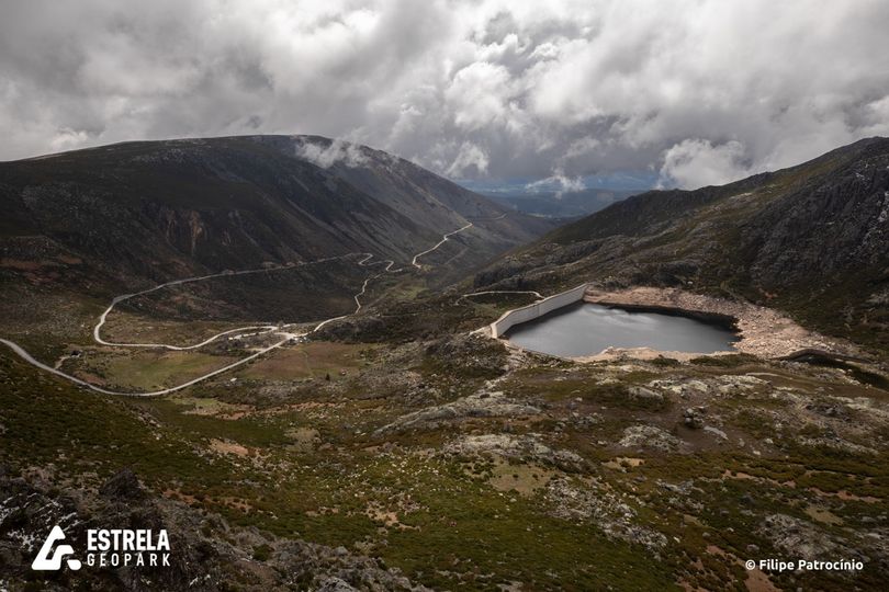
From Covão, follow the trail (marked on the map) to the east of the tower going down the steep slopes of Covão do Ferro and passing to the right of the Padre Alfredo Dam whose waters supply Unhais da Serra. After the dam, continue along the path that goes down the slope of the Terroeiro spring, through the worst heaths, heathers and heaps of stones that rolled off the slope and through which you can hear the running of the waters. Continue along the slope along Covão da Mulher, between ravines and deposits on the slope reaching the canal. Continue to the old town of Belo Horizonte observing its characteristics that are almost identical to those of thousands of years ago. In this place the valley reached an ice thickness greater than 200 meters. Continue now the route seeing the rocks transported through the vegetation at the junction of Ribeira das Cortes between the Glacier Valley of Estrela and the Glacier Valley of Alforfa, on the opposite side to the one where we are. Follow until Cabeçada and turn right entering the forest path that goes down the slope that goes down to Cruzeiro. Continue on the road until Unhais da Serra where the route ends.
Car Route: Duration: 50 m Distance: 14 km. (advisable to use an off-road vehicle)
Exit the Tower towards Covilhã. Pass by the Cântaro Magro and, just ahead, by Nossa Senhora da Estrela. Follow curves and counter-curves until you come across the Poio Judeu on the left. Go around Nave de Santo António and take the road on the right. However, in Covão da Mulher, follow the road (a little worn), seeing the rocks transported from the opposite side to the one where we are. Continue on the road. Pass the old town of Belo Horizonte and Cabeçada until you reach Unhais da Serra where the route ends.